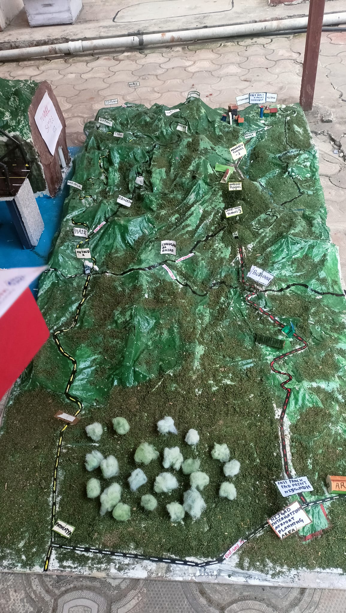
Project Overview
This project focused on preparing a detailed 3D model and route interpretation for the Kathmandu-Terai Fasttrack corridor. The objective was to visualize key alignment sections, bridge locations, and terrain transitions to support planning and design communication.
The work emphasized realistic representation of mountainous and valley sections so project stakeholders could quickly understand geometric constraints and feasibility challenges.
Methodology
Data Collection: Reference maps, elevation profiles, and publicly available corridor information were reviewed for a base model framework.
Model Development: A 3D conceptual model was prepared with emphasis on route continuity, terrain context, and major structures.
Interpretation: Alignment sensitivity, topographic limitations, and likely construction complexities were highlighted for academic and technical discussion.
Project Visuals